

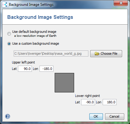
The Background Image Settings window allows to specify an alternative background image for the map.
A default background image can be selected, this image is a low-resolution image of Earth from Natural Earth.
A custom image can be specified. This image must be lat/long projected. The latitude/longitude-coordinates of the upper left and lower right corner of the image can be modified. This allows to use images that cover only parts of Earth's surface.
Special file naming
If the file name of the image ends with four numbers separated by _, these numbers are used as lat, long of upper left point and lat, long of lower right point (in this order).
Example: Germany_Wikimedia_55.1_5.5_47.2_15.5.jpg gives upper left point lat 55.1, long 5.5, lower right point lat 47.2 and long 15.5.
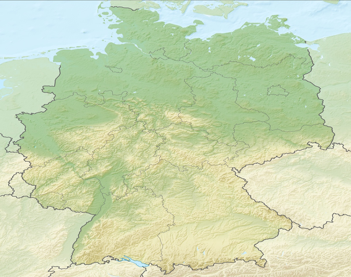
(Image Source: http://commons.wikimedia.org/wiki/File:Relief_Map_of_Germany.png. This file is licensed under the Creative Commons Attribution-Share Alike 3.0 Unported license. It was reprojected to lat/lon.)
Image sources
Better resolution images are available here:
FOR RESEARCH USE ONLY. NOT FOR USE IN CLINICAL DIAGNOSTIC PROCEDURES.